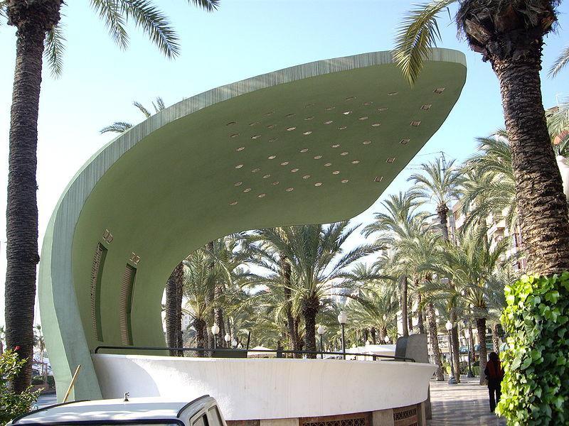
Alicante, Comunidade Valenciana, Spain
Suggest Place to Visit
4656
Track to location with GPS |
 |
origins
The origins of the urban settlement in the garden and surroundings of Alicante date back to Iberian settlements. There is archaeological evidence of nearby Phoenician commercial factories (the Palmeral of Elche, the Baños de la Reina in Campello ...). The Greek settlers of Phocea, in Asia Minor, took Mount Benacantil as a reference, calling it Akra Leuka (´´white peak´´) and could be the first to assess the possibilities offered by its summit as a military settlement, although there is no certainty of construction. until Amilcar Barca placed his main barracks there shortly before the Second Punic War. In 201 a. C. the Romans capture the Iberian city of the nearby Tossal de Manises known as Leucante or Leucanto (Lucentum is a Latinization of the original name that only existed in Roman maps) that had an acceptable sea-river port and that will be the first site of what in time would become Alicante.
Late Roman-Visigothic period
The siltation of the torrent that flows next to the town of Leucante / Lucentum makes it no longer suitable as a port and the settlement is surrounded by marshes and malarious and unhealthy swamps; reason why its population is moving progressively towards the slopes of Benacantil, giving rise to the true origin of the current urban area.
Islamic period
Between 718 and December 4, 1248, the city fell under Islamic rule, and was renamed Al-Laqant, or Medina Laqant = ´´old city´´ (note that the Valencian place name is Alacant). During this period, the city followed the destinies of Al-Andalus and after the dismemberment of the Caliphate of Córdoba it belonged to the Taifas of Denia and Murcia.
Barrio de Santa Cruz from the slopes of Castillo de Santa Bárbara.
Christian conquest
By virtue of the treaty of Cazola (Soria, 1179) between Alfonso VII of Castile and Alfonso II of Aragon, the southern border of Aragon was set on the line that joins Biar, Castalla, Jijona and Calpe. Therefore Alicante belonged to the Castilian expansion zone. In 1243, the Muslim ruler of the Taifa of Murcia, Muhamad ben Hud, signed the Alcaraz Pact with the infant Don Alfonso, who later became King Alfonso X el Sabio, by which the Muslim kingdom of Murcia was put under Castilian protectorate.
Although in principle the city was repopulated, the lack of sufficient Christian settlers coupled with economic reasons prolonged the permanence of the Muslim population. However, the governor of Alicante, Zayyan ben Mardanis, did not accept the pact and was forced, accompanied by many settlers, to leave the area in 1247, the date on which the Castilian sovereignty of Alicante began. The military conquest was finalized on December 4, 1248 with the troops of the Castilian king, commanded by his son the Infante Alfonso, future Alfonso X el Sabio. [1] By the Treaty of Almizra signed in 1244 between the kings of Castile and Aragon, in which the limits of the expansion of their respective domains were set on the line from Biar to Villajoyosa, Alicante remained under Castilian sovereignty for a period of 48 years . King Alfonso X el Sabio, once the town was taken from the Andalusians, commemorates the victory by naming the Arab castle built on Mount Banu-l-Qatil (where ´´Benacantil´´ comes from) ´´de Santa Bárbara´´, because this festival coincides with the day of the taking of the city by Christianity.
Castilla's crown
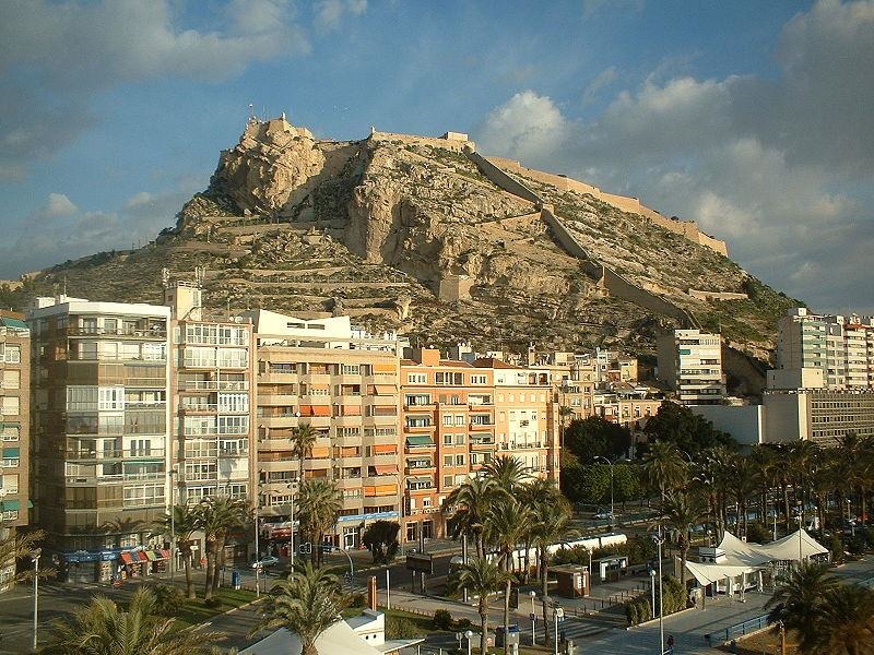
Benacantil and Castillo de Santa Bárbara.
From the beginning, Alfonso X the Wise tried to establish a large group of Christians in Alicante given the town's military and commercial importance, but the repopulation process was slow and lasted throughout the 13th century, although it is little documented from cause of the disappearance of the Cast Books. The Christian settlers, mainly Castilian and Leonese, [2] received all kinds of privileges and franchises to facilitate their settlement. In order to better ensure its growing population and more actively promote its greater economic and commercial promotion, in August 1252 Alfonso X granted the city the Royal Charter, very similar to that of Córdoba. It endowed the town with a strong council, numerous tax exemptions and a wide municipal area, which included the current municipalities of Agost, Monforte del Cid, Aspe, Novelda, Elda, Petrel, Busot, Aguas de Busot, Campello, Muchamiel, San Juan and San Vicente del Raspeig. In addition, the Castilian king dispensed great measures of favor to the port of Alicante, considered of great strategic value.
Between 1264 and 1266 Alicante was immersed in a Mudejar rebellion that spread throughout almost the entire Kingdom of Murcia; the Castilian king, then employed in the siege of Niebla, requested help from his father-in-law Jaime I of Aragon to suffocate it. This one intervened quickly and reduced all the rebellious cities to the acceptance of Castilian sovereignty.
Crown of Aragon
Due to a dynastic crisis due to the succession of Sancho IV el Bravo, the Infante Fernando de la Cerda, an illegitimate aspirant to the Crown of Castile, asked Jaime II of Aragon for help in exchange for donating him, in case of obtaining the Crown, the Kingdom of Murcia, according to the secret agreements of Calatayud (1289), Ariza (January 1296) and Serón (February 1296). Taking advantage of the situation, Jaime II proceeded to the conquest of the Kingdom of Murcia.
Alicante was conquered in April 1296, despite the resistance of the castle warden Nicolás Peris, ending the Castilian sovereignty. The conquest was, in part, facilitated by Christian settlers of Catalan or Aragonese origin (such as, for example, the help of the Torregrossa family, on whose shield the current coat of arms of the city is based). Even so, Jaime II respected the previous privileges and institutions, although adapting them to the new political situation, particularly after the incorporation of Alicante, and the rest of the neighboring regions to the Kingdom of Valencia by modifying what was established in the Treaty of Almizra (Sentencia Arbitration of Torrellas, 1304 and Treaty of Elche, 1305).
The Christian repopulation continued, this time with Catalans and, to a lesser extent, Aragonese, with a greater speed and number, for which the originally Castilian population remained in a minority among the Christian population. Even so, until the first expulsion of the Moors, the population of Arab origin was in the majority compared to the Christians. The repopulation was mainly of Lleida, hence the language used since then, apart from Castilian, is the one that is linguistically called Western Catalan.
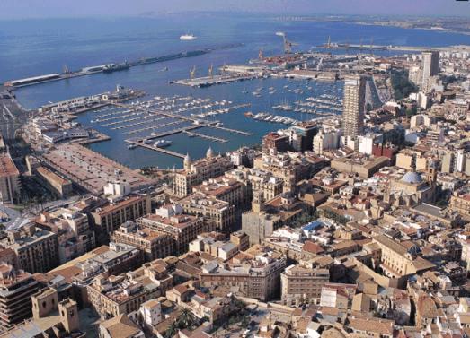
The city is located on the shores of the Mediterranean, on a plain surrounded by a series of hills and elevations. Mount Benacantil, 169 m high, on which the Castillo de Santa Bárbara sits, dominates the urban façade and constitutes the most characteristic image of the city. In this we also find the Tossal, where the castle of San Fernando is located, the San Julián or Serra Grossa mountains, the Garbinet hills and the Tossal de Manises. Ravines and valleys run between these, some completely hidden by urban growth such as the Ramblas de Canicia, Bon Hivern or San Blas-Benalúa; others, larger, are channeled, such as Rambla de las Ovejas or Juncaret. To the south of the city there is a swampy area, the Agua Amarga salt marsh.
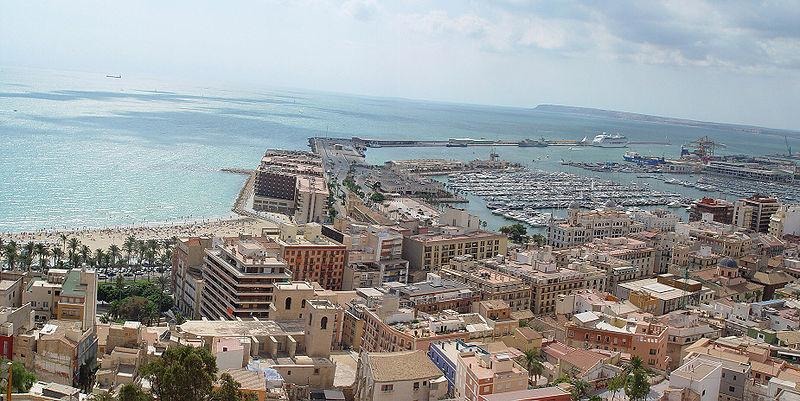
On the coastline, it is worth noting the beaches that are, from north to south: San Juan, La Almadraba, La Albufereta, El Postiguet, Agua Amarga, El Saladar, and those of the island of Tabarca. Between the beaches of La Albufereta and San Juan is Cabo de las Huertas, with numerous coves: Calabarda, Cantalares, Los Judíos, La Palmera.
There is a great unevenness within the same city: while the City Hall is at 0 m and it is taken as a reference to measure the height of any point in Spain, there are neighborhoods at the same level, such as Playa de San Juan, others at a higher altitude such the Pla del Bon Repós and San Blas at 30 m, Los Ángeles at 75 m, or the Ciudad Jardín del General Marvá and Virgen del Remedio at more than 80 meters.
The municipal area covers just over 200 km² and stands out as the maximum elevation of 1,208 m of Cabezón de Oro. There are also lower mountains such as the Águilas, Alcoraya, Mediana, Fontcalent (426 m), Sancho and Los Tajos mountains. that separate Alicante from the Vinalopó regions. These elevations are formations composed of limestone, marl and sandstone materials. Regarding hydrography, it is worth mentioning the basins of the Monnegre or Seco river and the Rambla de las Ovejas. The island of Tabarca also stands out, opposite Cape Santa Pola and which is part of the municipality.
Historical-artistic heritage [edit]
See also: Museums of Alicante
Central Market of Supplies of Alicante.
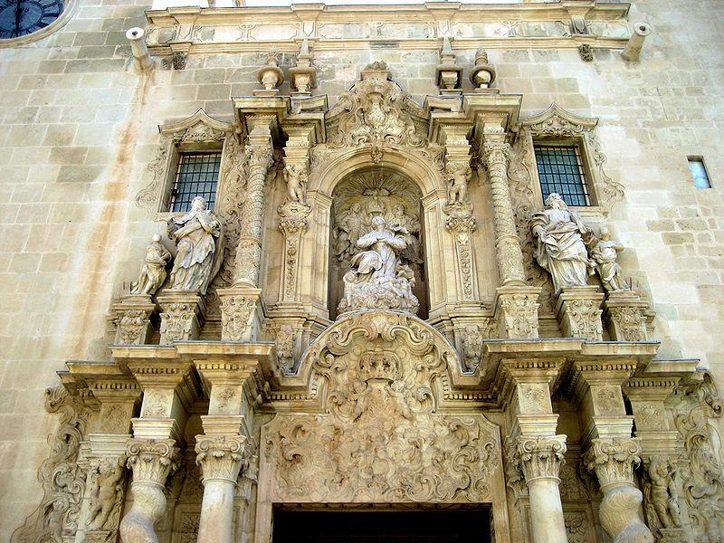
Basilica of Santa María (XIV-XVI centuries). Built in the Gothic style, it was built over the old Great Mosque and it is the oldest temple in the city. Its main altar, in the Rococo style, and its façade, in the Baroque style, both from the 18th century stand out.
Co-Cathedral of San Nicolás de Bari (XV-XVII centuries). Also built on the remains of another mosque, it is in the Herrerian Renaissance style. Sober in its external appearance, its construction was carried out between 1616 and 1662, although its oldest cloister dates from the 15th century. It was raised as a co-cathedral in 1959, although the cathedral seat is the Santa Iglesia Catedral del Salvador de Orihuela.
Monastery of the Holy Face (15th century). Located 5 km north of the urban area, it is in the Baroque style. Every year, on the second Thursday after Easter, there is a massive pilgrimage that starts from San Nicolás to this monastery.
Defense Towers of the Huerta de Alicante (XV-XVII centuries). Defensive bulwarks built in the Huerta de Alicante to defend themselves from the attacks of the Berber pirates. At present little more than 20 towers are preserved. Some of them are of great beauty, such as Verónica, Reixes or Bonanza. They are declared a Site of Cultural Interest with the category of monument, which has not prevented some from being in ruins.
House of the Insured (17th century). The oldest civil construction in the city, it was built in 1685 in a baroque style. It is located in the same square as the Basilica of Santa María and currently houses the Museum of Contemporary Art of Alicante.
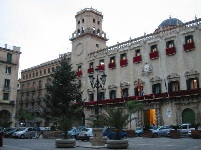
Alicante Town Hall (18th century). Reference point for measuring the altitude above sea level of any point in Spain, it is a baroque civil architecture.
Canónigas de San Agustín Convent (18th century). Begun in 1732, his works spread until the beginning of the 19th century. In this convent resides the oldest processional virgin of the city ´´La Marinera´´, since the first Marian representation of the City can be found in the Basilica of Santa María, a stone carving from the 14th century.
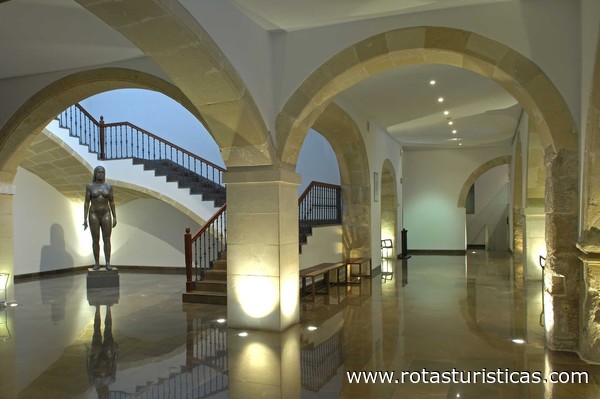
Gravina Palace (18th century). Built between 1748 and 1808 as the palace of the Count of Lumiares, it currently houses the Gravina Museum of Fine Arts, dedicated to regional painting and sculpture from the 16th to the early 20th centuries.
Palace of the Provincial Council of Alicante.
Maisonnave Palace - Municipal Archive (18th century). Palatial house located in the old town, on the ground floor remains of a late Roman necropolis have been found.
Alicante Principal Theater (19th century). Neoclassical building, it was inaugurated in 1847.
Central Market of Alicante (20th century). In a regionalist style, it was built in 1911 on the 18th century wall that surrounded the city.
Building of the Provincial Council of Alicante (20th century). Neoclassical palace, it was inaugurated in 1931.
Fish Market (20th century). From the beginning of the 20th century, it is an industrial building in a historicist style, which integrates neo-Arab ornamental details. It has served as an exhibition hall since 1992.
Castle of Santa Bárbara (XIV-XVIII centuries). Located in the highest part of Mount Benacantil, it dominates the entire Huerta de Alicante and from it you can see the island of Tabarca. Old Moorish castle, it was rebuilt by the Christians and consists of three precincts from the 14th, 16th and 18th centuries.
Castle of San Fernando (19th century). It was built in 1813 to defend the city from the Napoleonic invasion.
In addition, in Albufereta there are the archaeological remains of the Ibero-Roman city of Lucentum, which dates back to the 4th centuries BC. C. to III d. C.
Comments
We don´t have yet any comments about:
Alicante
Alicante
Be the first to leave a comment as it is very important to inform other people
Outros locais a visitar
Within a radius of 20 km from:Alicante
Gravina Museum of Fine Arts |
| 0,1 Km |
 |
Alicante City Council |
| 0,2 Km |
 |
Basilica of Santa Maria (Alicante) |
| 0,2 Km |
 |
Santa Bárbara Castle |
| 0,5 Km |
 |
Lonja del Pescado |
| 1,0 Km |
 |
Archaeological Museum of Alicante |
| 1,1 Km |
 |
Port of Alicante |
| 1,2 Km |
 |
Alicante |
| 2,7 Km |
 |
Albufereta (Alicante) |
| 4,3 Km |
 |
QUERCUS ARQUEOLOGÍA |
| 5,0 Km |
 |
Santapola |
| 17,2 Km |
 |
Pola Park |
| 18,4 Km |
 |
Tabarca Island (Alicante) |
| 19,9 Km |
 |
Hotel reservation near Alicante within a radius of 20 km
Why to book with BOOK HOTEL ALGARVE
The best prices
Our partnerships with the world´s largest operators offer research on the best market prices.
More options
At Rotas Turisticos you can book the hotel, buy the air ticket, book the transfer from the airport to the hotel and vice versa, book the local excursions, rent the car, take travel insurance and consult the places to visit and where to go.
Holiday Tips & Destinations
Hundreds of holiday destinations with all the options that allow you to easily choose the destination that best suits your dream vacation.
BOOK HOTEL ALGARVE
Links


